Map
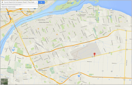
Google Maps shows very clearly how detached the proposed site of the new hospital is from the city. Its location at the far end of the airport land means there is no direct way to access it. It is immediately clear that this major community institution will no longer anchor the heart of Windsor.
|
Note: It is important to question all distance projections that don't specify whether they are as the crow flies, or exact routes. Many W-E residents who technically live within 10km of the County Rd 42 location will find themselves travelling much further in order to get around the airport land. All of CAMPP's distance projections are exact, and we have selected the shortest routes available in our calculations, even if they aren't always the fastest.
|
Impact on Transit
How many people have given much thought to the realities of expanding our transit lines to serve the hospital (marked yellow in the south east corner of the airport land below)?
How many people have given much thought to the realities of expanding our transit lines to serve the hospital (marked yellow in the south east corner of the airport land below)?
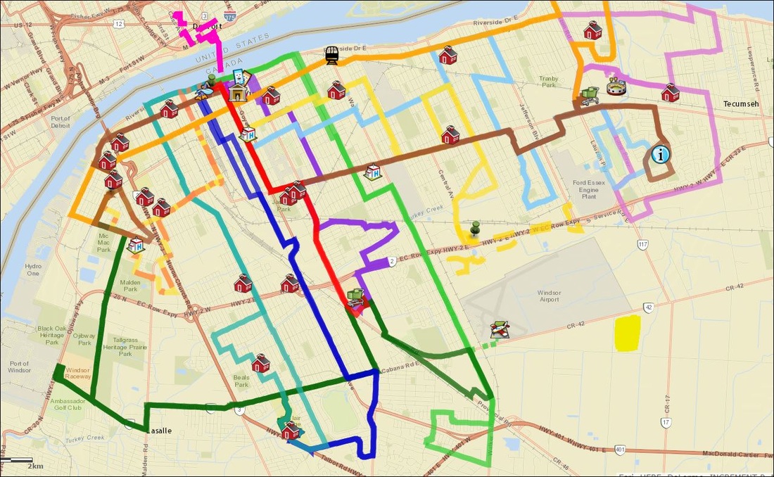
Source: http://www.arcgis.com/apps/OnePane/basicviewer/index.html?appid=98e10abac33e4f6c873e174ad9cf1a9a
How many people have given much thought to the realities of expanding our transit lines to serve the hospital (marked yellow in the south east corner of the airport land)?
Remember that Council has recently authorized a fare increase to pay for the current transit services. What will be the impact of a hospital outside the core?
How many people have given much thought to the realities of expanding our transit lines to serve the hospital (marked yellow in the south east corner of the airport land)?
- Currently 4 buses come to Ouellette Campus, and 2 serve Met Campus.
- The South Windsor 7 and Walkerville 8 take passengers to the airport today. Will those lines simply be extended to the hospital?
- Will the Lauzon 10 be extended for residents who live in East Windsor?
- Will passengers living north of the airport get a new direct line or will they need a transfer?
- If the lines are extended, the total route will take longer to complete. Will extra trips be added to ensure passengers can get to their destinations on time?
Remember that Council has recently authorized a fare increase to pay for the current transit services. What will be the impact of a hospital outside the core?
